Traveling cross Country by Car

This is written in response to Molly Templeton’s call for submissions in response to the New York Times‘ How-To issue.
==
Everyone should drive cross-country at least once in their life. Driving with a friend or a car full of people, it’s a life-changing experience. But by yourself, it is a moment of reckoning. Those hours and hours and hours behind the wheel with only yourself and your iPod playlist are as transformative as round-the-world travel.
The changing landscape, the weather, the horizon, the rolling hills, the flatness, the mountains, the clouds, the sky, the grass, the desert, truck stops, street lights, bad roadside attractions; with only yourself to filter these things through, they become more profound. I drove cross-country by myself twice, and to this day I still carry the very vivid images in my head. I have only ever thought “wow, that thing about the purple mountains majesty is true” when driving cross-country. I have never seen so many trains in my life.
You have hours to think. Hours and hours and hours. This can be good or bad, or both, often at the same time.
I have driven cross-country from Seattle to NYC three times, twice by myself (part 1 | part 2). I did this in 2003, which is almost another century in car travel given the advent of smartphones and mp3 players. While there are endless sites telling you what to see and what route to take and where to stop to see the World’s Largest Ball of Twine, there are some basic tenets derived from experience that I believe apply to a successful cross-country car journey.
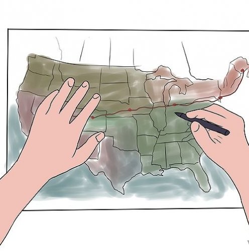
1) Don’t rely on your GPS or your smartphone. Get a map, learn to read it, study it.
Data signal will fail you when you need it the most, on a dark rainy night when you took the wrong turn off of a detour and there is no one around to ask for directions. Get maps. Find someone with a AAA membership or just buy some. They give you context for the journey that you just don’t get by putting two points into Google Maps and asking for directions. By all means, do that, but then look at the route on a map and see if it makes sense to you, try to figure out your likely stopping points, see what’s interesting along the way. (I mourn for the demise of Expedia Streets & Trips. I still have my printout of my route filed away.)
You don’t need a GPS. It’s overkill, unless you are totally winging it, and even then, it defeats the point of totally winging it if you know exactly where you are. Get some maps.
You might also like

|
Bling Bling Style Shiny Crystal Rhinestone on Korean Velvet Leather with Magnet Clasp Friendship Bracelet (#246 Lt. Colorado Topaz) Jewelry (JewelrieShop)
|
